Editor Profile

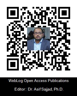
Dr. Asif Sajjad, Ph.D.
Assistant Professor
Sep 2022 - Present
Quaid-I-Azam University
Islamabad
Pakistan

Dr. Asif Sajjad was born in Kot Addu, Punjab, Pakistan. He is currently working as an assistant professor at Quaid-e-Azam University, Islamabad. He is also an incharge of the Quaidian Disaster Risk Management Society (QDRMS), which is a university-level society. He has completed his PhD (GIS and Cartography) from the State Key Laboratory of Information Engineering in Surveying, Mapping and Remote Sensing (LIESMARS), Wuhan University, China. He did a Master of Science (MS) and a BS (Hons.) in Geography from the Department of Geography, Government College University, Lahore, Pakistan.
- GIS and Remote Sensing Applications on Natural Hazards
- Flood Mapping and monitoring
- Flood Modeling
- Water Resource Management
- Flood Hazards Assessment and Management
- Sajjad A.; Tabassum, A.; Mazhar, N.” "Flood Risk Modeling using Analytic Hierarchy Process in Dera Ismail Khan, Khyber Pakhtunkhwa, Pakistan" accepted on 23-11-2024 for the Springer e-Book titled “Flood Risk Reduction: Cutting-Edge Strategies and Innovative Technologies”.
- Chaoyong, W.; Aslam, RW.; Quddoos, A.; Naz, I.; Tariq, A.; Ullah,S.; Sajjad, A.; Soufan, W.; Almutairi, KF. “SAR image integration for multi-temporal analysis of Lake Manchar Wetland dynamics using machine learning”. Scientific Report, 2024, 14: 26669. https://doi.org/10.1038/s41598-024-76730-1
- Mazhar, N.; Fatima,T.; Nasar-u-Minallah,m.; Sajjad, A.; Abbas, S. “Spatio-Temporal Monitoring and Risk Mapping of Glacial Lake Outburst Flood in Hunza Valley, Pakistan”. Proceedings of the Pakistan Academy of Sciences: A. Physical and Computational Sciences, 2024, 61(3): 865. https://doi.org/10.53560/PPASA(61-3)865
- Lingye T; Saleem, N,; Aslam, RW,; Sajjad, A*,;Naz, I,; Tariq, A,; Alzahrani,H. “Assessment of Urban Environmental Quality by Socio-Economic and Environmental Variables Using Open Sources Datasets”. Transactions in GIS, 2024, 28: 2526-2544.
- Naz, I.; Fan, H.; Aslam, RW.; Tariq, A.; Quddoos, A.; Sajjad, A*.; Soufan, W.; Almutairi, KF.; Ali, F. “Integrated geospatial and geostatistical multi-criteria evaluation of urban groundwater quality using water quality indices”. Water, 2024, 16, 2549.
- Sajjad, A*.; Lu, J.; Chen, X,; Yousaf, Y,; Mazhar, N,; Shuja, S. “Flood hazard assessment in Chenab River basin using hydraulic simulation modeling and remote sensing”. Nat Hazards, 2024, 120, 7679–7700.
- Aslam, R.W.; Shu, H.; Yaseen, A; Sajjad, A.; Zain ul Abidin, S. “Identification of time-varying wetlands neglected in Pakistan through remote sensing techniques”. Environ Sci Pollut Res. 2023, 30, 74031–74044 https://doi.org/10.1007/s11356-023-27554-5
- Sajjad, A*.; Lu, J.; Aslam, R.W.; Ahmad, M. “Flood Disaster Mapping Using Geospatial Techniques: A Case Study of the 2022 Pakistan Floods”. Environ. Sci. Proc. 2023, 25, 78 9.
- Sajjad, A*,; Lu, J.; Chen, X. “Rapid assessment of riverine flood inundation in Chenab floodplains using remote sensing data” Geoenvironment Disasters, 2023,10,9.
- Sajjad, A.; Lu, J.; Chen, X.; Chisenga, C.; Mazhar, N.; Nadeem, B. “Riverine Flood mapping and impact assessment using remote sensing technique: A case study of Chenab flood-2014 in Multan district, Punjab, Pakistan”. Nat Hazards, 2021, 110, 2207–2226.
- Sajjad, A.; Mahmood, S.; Rahman, A. U. “Cause and damage analysis of 2010 flood disaster in district Muzaffar Garh, Pakistan”. Natural Hazards, 2021, 107, 1681-1692. https://doi.org/10.1007/s11069-021-04652-6
- Mazhar, N.; Shirazi, S. A.; Javid, K.; Sajjad, A. “Application of unmanned aerial vehicles (UAVs) for precision agriculture, in selected wheat fields of Rajanpur”. Pakistan Geographical Review, 2021, 76, 213-223.
- Waqas, H.; Lu, L. Xing, J.; Sajjad, A. “Flash Flood Susceptibility Assessment and Zonation Using an Integrating Analytic Hierarchy Process and Frequency Ratio Model for the Chitral District, Khyber Pakhtunkhwa, Pakistan”. Water, 2021, 13,1650. DOI: https://doi.org/10.3390/w13121650
- Sajjad, A.; Lu, J.; Chen, X.; Chisenga, C.; “Operational monitoring and damage assessment of riverine flood-2014 in the lower Chenab plain, Punjab, Pakistan, using remote sensing and GIS techniques”. Remote Sensing, 2020, 12, 714. https://doi.org/10.3390/rs12040714
- Sajjad, A.; Lu, J.; Chen.; Saleem, N. “Rapid riverine flood mapping with different water indexes using flood instances Landsat-8 images”. 5th International Electronic Conference on Water Sciences,2020. https://doi.org/10.3390/ECWS-5-08049
- Basit, M.; Sajjad, A.; Mahmood, Z.; Sohail, M. “Spatial assessment of transgender population: The deprived community on Pakistan”. Arts and Social Science, 2020, 1, 1–12. https://doi.org/10.34154/2020-ASSJ-0202-01-12/euraass
- Sajjad, A.; Lu, J.; Chen, X.; Chisenga, C.; Mahmood, S. “The riverine flood catastrophe in August 2010 in South Punjab, Pakistan: potential causes, extent and damage assessment. Appl. Ecol. Environ. Res., 2019, 17, 14121-14142. http://dx.doi.org/10.15666/aeer/1706_1412114142
- Mahmood, S.; Rahman, A. U.; Sajjad, A. Assessment of 2010 flood disaster causes and damages in district Muzaffargarh, Central Indus Basin, Pakistan. Environmental Earth Sciences, 2019. 78, 63. https://doi.org/10.1007/s12665-019-8084-8
- Saleem, N.; Huq, M.; Twumasi, N. Y. D.; Javed, A.; Sajjad, A. “Parameters derived from and/or used with digital elevation models (DEMs) for landslide susceptibility mapping and landslide risk assessment: a review”. ISPRS International Journal of Geo-Information, 2019, 8, 545. https://doi.org/10.3390/ijgi8120545
- Basit, M.; Sajjad, A. “Female Deficit: Trends and Patterns of Sex Ratio in Pakistan, Directing Census- 2017” Asian Journal of Multidisciplinary Studies, 2019, 7(1).


