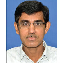
Editor Profile

Dr. Rajat Subhra Chatterjee, Ph.D.
Scientist 'G' & Group Director
Present
Geosciences & Disaster Management Group, Indian Institute of Remote Sensing
Dehradun-248001, Uttarakhand
India

Dr. Rajat Subhra Chatterjee is Scientist ‘G’, Head of the Geosciences Department, and Group Director of the Geosciences & Disaster Management Group at the Indian Institute of Remote Sensing (IIRS), Indian Space Research Organisation (ISRO), Department of Space, Government of India, Dehradun. An alumnus of IIT Kharagpur with top academic honours, Dr. Chatterjee holds advanced degrees in geology and remote sensing, a Ph.D. from IIT Kharagpur, and post-doctoral research experience from France.
With over 27 years of teaching and research experience, Dr. Chatterjee is an expert in remote sensing and GIS-based Earth and planetary studies, geodynamics, groundwater and mining hazards, tectonic geomorphology, and microwave and thermal remote sensing applications. He has executed over 18 national and international research projects, including collaborations with NASA, ESA, CSA, JAXA, and DLR, and has published extensively in reputed journals and conferences.
A distinguished mentor, Dr. Chatterjee has supervised 13 Ph.D. theses, mentored post-doctoral research, and guided over 100 postgraduate projects. His contributions have been recognised with prestigious awards such as the WCDM–DRR Award (2024), ISRO Team Excellence Award (2015), and the P.R. Pisharoty Memorial National Remote Sensing Award (2010).
An IEEE Senior Member and active contributor to several international scientific bodies, Dr. Chatterjee is widely regarded for his leadership in advancing geospatial science, satellite-based hazard assessment, and planetary exploration initiatives within ISRO and beyond.
- Remote Sensing-based Earth and Planetary Studies.
- Geoinformatics & Geospatial Analysis for Geological Hazards Studies.
- Microwave Remote Sensing for Geological Studies.
- Interferometric SAR for Geological & Geo-environmental Studies.
- Thermal Remote Sensing for Geological & Geo-environmental Studies.
- Remote Sensing-based Applied & Tectonic Geomorphology.
- Remote Sensing-based Geological Hazards Studies, including Mining Hazards, Hydrogeology, Geodynamics and Active Tectonics.
- Interferometric SAR for Land Surface Deformation Measurements & Predictive Modelling: Groundwater depletion and Mining induced Land Subsidence Measurements & Modelling, Precursory Slope Movements for Landslide Forewarning.
- Thermal Remote Sensing for Geological & Geoenvironmental Studies: Detection and Spatiotemporal Dynamics of High Temperature Anomalies (e.g., Surface and Subsurface Coal Fire).
- Satellite Remote Sensing, Spaceborne Gravity, Interferometric SAR and Geographic Information Systems for Groundwater Studies: Groundwater Storage Change Estimation and Aquifer-system Compaction vs. Dilation Modelling.
- Chatterjee, R.S., Kayal, J.R., 2025. Myanmar Earthquake Mw 7.7 on March 28, 2025: Geodynamic and Spaceborne DInSAR Perspectives, Current Science Journal, Indian Academy of Sciences (Accepted).
- Khali, H., Chatterjee, R.S., Rawat, K.S., Kunwar, S., Deep A., 2025. Artificial Intelligence and Machine Learning Driven Landslide Analysis: Scar Segmentation, Susceptibility and Sensitivity Analysis using Naive Bayes and K-nearest neighbor in Nainital district, Uttarakhand, International Journal of Advanced Science and Engineering (Accepted).
- Khali, H., Chatterjee, R.S., Rawat, K.S., 2025. Geohazard linkages with surface geodynamics: a short-term temporal topographic analysis of mass movement and gradation patterns in the upper bhagirathi basin, Discover Applied Sciences, DOI: 10.1007/s42452-025-07665-z.
- Kumar, H., Suman, S., Rawat, A., Chatterjee, R.S., Kumar, D., Chaudhary, B.S., 2025. A GIS Based Earthquake Hazard Pattern Identification Implementing the Local Site-Specific Parameters and the Historical Seismicity, Revue Internationale de Geomatique, 34(1), 351-362, Doi:10.32604/rig.2025.064031
- Pranjal, P., Kumar, D., Soni, A., Chatterjee, R.S., 2024. Assessment of groundwater level using satellite-based hydrological parameters in North-West India: A deep learning approach, Earth Science Informatics (IF: 3.14). DOI: 10.1007/s12145-024-01263-0
- Chatterjee, R.S., Singha, S., Aggarwal, A., Sharma, V., Karunakalage, A., Jain, P.K., Nagar, A., Mitra, D.S., Kumar, D., Patel, N.R., Chauhan, P., 2023. Reconnaissance to characterisation of land subsidence due to groundwater overdraft and oil extraction in and around Mehsana City, Gujarat, India by long-term hybrid differential interferometric SAR technique, Journal of Hydrology (IF: 6.71). DOI: 10.1016/j.jhydrol.2023.130441
- Chatterjee, R.S., Pranjal, P., Kannaujiya, S., Thapa, S., Bhardwaj, A., Kapoor, U., Dwivedi, S.N., Chandra, R., Srivastava, R.K. Singh, S.K., Kumar, H., Bhattacharjee, R., Singha, S., Kala, S., Kumar, A., 2023. Unravelling the dynamics and causes of land subsidence in the National Capital Territory of Delhi, India, by spaceborne and in situ observations, Bulletin Engineering Geology and the Environment (IF: 4.13). DOI: 10.1007/s10064-023-03399-7
- Niraj, K.C., Chatterjee, R.S., Shukla, D.P., 2023. Estimating the period of probable landslide event using advanced D-InSAR technique for time-series deformation study of Kotrupi region, Geomatics, Natural Hazards and Risk, 14:1 (IF: 3.92). DOI: 10.1080/19475705.2023.2281245
- Khali, H., Rawat, K.S., Chatterjee, R.S., 2023. Dynamic association of slope movements in the Uttarakhand Himalaya: a critical review on the landslide susceptibility assessment, Geomatics, Natural Hazards and Risk, 14:1 (IF: 3.92). DOI: 10.1080/19475705.2023.2273214
- Kumar, H., Chatterjee, R.S., Patel, R.C., Rawat, A., Nath, S., 2023. Geomorphic mapping and analysis of neotectonic structures in the piedmont alluvial zone of Haryana state, NW-India: a remote-sensing and GPR based approach, Geomatics, Natural Hazards and Risk, 14:1 (IF: 3.92). DOI: 10.1080/19475705.2023. 2221371
- Pranjal, P., Chatterjee, R.S., Kumar, D., Dwivedi, S., Jally, S.K., Kumar, B., 2023. Satellite gravity observation and hydrological modelling-based integrated groundwater storage change in Northwestern India, Journal of Hydroinformatics, 17p (IF: 3.06). DOI: 10.2166/hydro.2023.072
- Mujawdiya, R., Chatterjee, R.S., Kumar, D., 2023. A time series decomposition approach to detect coal fires in parts of the Gondwana coalfields of India from VIIRS data, Journal of Spatial Science, 16p (IF: 1.84). DOI: 10.1080/14498596. 2023.2183431
- Chatterjee, R.S., Kumar, K., Pranjal, P., Kannaujiya, S., Chauhan, P., 2022. Magmatic inflation, miniature dyke intrusion and prolonged torrential rainfall led to the emergence of the 2018 aseismic fissure in Kenya, Natural Hazards, 115, 565-591 (IF: 3.16). DOI: 10.1007/s11069-022-05566-7
- Srijayanthi, G., Chatterjee, R.S., Kamra, C., Chauhan, M., Chopra, S., Kumar, S., Chauhan, P., Limbachiya, H., Champati ray, P.K., 2022. Seismological and InSAR based investigations to characterise earthquake swarms in Jamnagar, Gujarat, India – An active intraplate region, Journal of Asian Earth Sciences, 8, 12p (IF: 3.37). DOI: 10.1016/j.jaesx.2022.100118
- Rawat, A., Kumar, D., Chatterjee, R.S., Kumar, H., 2022. Reconstruction of liquefaction damage scenario in Northern Bihar during 1934 and 1988 earthquake using geospatial methods, Geomatics, Natural Hazards and Risk, 13(1):2560-2578 (IF: 3.92). DOI: 10.1080/19475705.2022.2122591
- Rawat, A., Kumar, D., Chatterjee, R.S., Kumar, H., 2022. A GIS-based liquefaction susceptibility mapping utilising the morphotectonic analysis to highlight potential hazard zones in the East Ganga plain, Environmental Earth Sciences, 81 (13) (IF: 3.12). DOI: 10.1007/s12665-022-10468-9
- Monika, Govil, H., Chatterjee, R.S., Bhaumik, P., Vishwakarma, N., 2022. Deformation monitoring of Surakachhar underground Coal mines of Korba, India using SAR interferometry, Advances in Space Science, 70 (3) (IF: 2.61). DOI: 10.1016/j.asr.2022.05.018
- Aggarwal, A., Srivastava, P.K., Gupta, D.K., Chatterjee, R.S., 2022. Estimating regional land subsidence in Mehsana urban block, Gujarat: Effect of groundwater induced aquifer compaction, Materials Today: Proceedings, 48 (5), 1217-1223 (IF: 2.59). DOI: 10.1016/j.matpr.2021.08.254.
- Pathak, P., Ghosh, P., Banerjee, S., Chatterjee, R.S., Muzakkira, N., Sikdar, P.K., Ghosal, U., Liang, M.C., Meeran, K., 2022. Relic surface water (clay-pore water) input triggers arsenic release into the shallow groundwater of Bengal aquifers, Journal of Earth System Science, 131 (2) (IF: 1.91). DOI: 10.1007/s12040-022-01819-y
- Pranjal, P., Kadiyan, N., Chatterjee, R.S., Kumar, D., Sati, M.S., 2021. Interpreting land subsidence impacts due to groundwater depletion using remote sensing-based GRACE gravity anomaly and DInSAR technique: a study on north-western parts of India. Environmental Earth Sciences, 80, 596 (IF: 3.12). DOI: 10.1007/s12665-021-09905-y
- Singh, N., Chatterjee, R.S., Kumar, D., Panigrahi, D.C., 2021. Spatio-temporal variation and propagation direction of coal fire in Jharia Coalfield, India by satellite-based multi-temporal night-time land surface temperature imaging, International Journal of Mining Science and Technology (IF: 7.67). DOI: 10.1016/j.ijmst.2021.07.002
- Kadiyan, N., Chatterjee, R.S., Pranjal, P., Agrawal, P., Jain, S.K., Angurala, M.L., Biyani, A.K., Sati, M.S., Kumar, D., Bhardwaj, A., Champati Ray, P.K., 2021. Assessment of groundwater depletion–induced land subsidence and characterisation of damaging cracks on houses: a case study in Mohali-Chandigarh area, India, Bulletin of Engineering Geology and the Environment, 80(4):3217–3231 (IF: 4.13). DOI: 10.1007/s10064-021-02111-x
- Nath, S., Chatterjee, R.S., Mohanty, S.P., Sharma, A., Prasad, A.V., 2021. Analysis of the maximum Principal Stress Directions in the Himalayas: A Remote Sensing Based Approach, Journal of Geotectonics, 55, 83–93 (IF: 1.14). DOI: 10.1134/S0016852121010088.
- Alam, M.S., Kumar, D., Chatterjee, R.S., 2021. Improving the Capability of Integrated DInSAR and PSI approach for Better Detection, Monitoring, and Analysis of Land Surface Deformation in Underground Mining Environment, Geocarto International (IF: 3.45). DOI: 10.1080/10106049.2020. 1864028.
- Mujawdiya, R., Chatterjee, R.S., & Kumar, D., 2020. MODIS land surface temperature time series decomposition for detecting and characterising temporal intensity variations of coal fire induced thermal anomalies in Jharia coalfield, India, Geocarto International (IF: 3.45). DOI:10.1080/10106049.2020.1818853.
- Singh, N., Chatterjee, R.S., Kumar, D., Panigrahi, D. C., Mujawdiya, R., 2020. Retrieval of Precise Land Surface Temperature from ASTER Night-time Thermal Infrared Data by Split Window Algorithm for Improved Coal Fire Detection in Jharia Coalfield, India, Geocarto International (IF: 3.45). DOI: 10.1080/10106049.2020.1753820.
- Chatterjee, R.S., Pranjal, P., Jally, S., Kumar, B. Dadhwal, V.K., Srivastav, S.K., Kumar, D., 2020. Potential groundwater recharge in north-western India vs spaceborne GRACE gravity anomaly based monsoonal groundwater storage change for evaluation of groundwater potential and sustainability, Groundwater for Sustainable Development Journal, 10 (IF: 6.27). DOI: 10.1016/j.gsd.2019.100307.
- Srivastav, S.K., Chatterjee, R.S., Kapoor, D., Sreenivasan, Parthsaradhy, E.V.R., 2020. Use of IRS-1C and Its Follow-On Missions for Geological Applications: A Review. Journal of the Indian Society of Remote Sensing, 49, 121-149 (IF: 2.5). DOI: 10.1007/s12524-020-01284-4.
- Mujawadiya, R., Chatterjee, R.S., Kumar, D., Singh, N., 2019. Detection of bad data images in long-term MODIS land surface temperature image time series using statistical outlier detection methods, Journal of Applied Remote Sensing, 13(4), 048504 (IF: 1.57).
- Bhardwaj, A., Jain, K., Chatterjee, R.S., 2019. Generation of high-quality digital elevation models by assimilation of remote sensing-based DEMs, Journal of Applied Remote Sensing, 13(4), 044502 (IF: 1.57). (IPR Copyright “Method(s) for Assimilation of Digital Elevation Models” jointly by Dr. Ashutosh Bhardwaj, Dr. Kamal Jain, and Dr. R.S. Chatterjee, Copyright Reg. No.: L-88896/2020, January 2020.)
- Gyeltshen, S., G., Tran, T.V., Gunda, G.K.T., Kannaujiya, S., Chatterjee, R.S., Champatiray, P.K., 2019. Groundwater potential zones using a combination of geospatial technology and geophysical approach: a case study in Dehradun, India, Hydrological Sciences Journal, 65(2), 169-182 (IF: 3.94).
- Nath, S., Chatterjee, R.S., Mohanty, S.P., Gaurav, S.K., 2019. Comparative evaluation of active tectonics in parts of the frontal region of NW Himalaya, India by geomorphic analysis and geophysical investigation, Journal of the Geological Society of India, 94, 197-205 (IF: 1.60).
- Alam, M.S., Kumar, D., Chatterjee, R.S., Upreti, V., 2018. Assessment of land surface subsidence due to underground metal mining using integrated spaceborne repeat-pass differential interferometric synthetic aperture radar (DInSAR) technique and ground-based observations, Journal of the Indian Society of Remote Sensing, 46 (6), 1569-1581 (IF: 2.5).
- Kumar, Y., Singh, S., Chatterjee, R.S., 2017. The Modeling of above Ground Biomass in Ranges of Corbett Tiger Reserve using Dual-Polarization ALOS PALSAR Data, Journal of Tropical Forestry and Environment, 7(2), 108-120 (IF: 0.96). DOI: 10.31357/jtfe.v7i2.3314.
- Kumar, Y., Singh, S., Chatterjee, R.S., 2017. The spectral modelling of above ground forest biomass in Jhajra forest range of Dehradun forest division using microwave data, Journal of Plant Development Sciences, 9 (10), 917-923 (IF: NA).
- Chatterjee, R.S., Singh, N., Thapa, S., Sharma, D., Kumar, D., 2017. Retrieval of land surface temperature (LST) from landsat TM6 and TIRS data by single channel radiative transfer algorithm using satellite and ground-based inputs, International Journal of Applied Earth Observation and Geoinformation, 58, 264-277 (IF: 7.67).
- Kodikara, G.R.L., Champati ray, P.K., Chauhan, P., Chatterjee, R.S., 2016. Spectral mapping of morphological features on the Moon with MGM and SAM, International Journal of Applied Earth Observation and Geoinformation, 44, 31-41 (IF: 7.67).
- Chatterjee, R.S., Singh, K.B., Thapa, S., Kumar, D., 2016. The present status of subsiding land vulnerable to roof collapse in the Jharia Coalfield, India, as obtained from shorter temporal baseline C-band DInSAR by smaller spatial subset unwrapped phase profiling, International Journal of Remote Sensing, 37(1):176-190 (IF: 3.53).
- Pati, J.K., Pruseth, K.L., Chatterjee, R.S., Patel, S.C, Prakash, K., Chakravorty, M., Singh, R.P., Bhushan, R., Malviya, V.P., Sharma, R., Champati ray, P.K., 2016. Hematite-rick concretions from Mesoproterozoic Vindhyan sandstone in northern India: a terrestrial Martian ‘blueberries’ analogue with a difference, 2016. Current Science, 111 (3), 535-542 (IF: 1.17).
- Yhoshü, K., Chatterjee, R.S., Champati ray, P.K., 2016. Secondary craters detection from Mini-SAR for lunar surface age dating, Current Science, 110 (3), 304-306 (IF: 1.17).Jhariya, D., Shrivastava, S., Nage, S.K., Chatterjee, R.S., 2015. Integrated remote sensing and GIS approach to groundwater potential delineation in the Doon valley, Uttarakhand, India, SSARSC International Journal of Geo-Science and Geo-Informatics, 2 (1), 1-12.
- Jhariya, D., Shrivastava, S., Nage, S.K., Chatterjee, R.S., 2015. Integrated remote sensing and GIS approach to groundwater potential delineation in the Doon valley, Uttarakhand, India, SSARSC International Journal of Geo-Science and Geo-Informatics, 2 (1), 1-12 (IF: NA).
- Chatterjee, R.S.,Thapa, S., Singh, K.B., Varunakumar, G., Raju, E.V.R., 2015. Detecting, mapping and monitoring of land subsidence in Jharia Coalfield, Jharkhand, India by spaceborne differential interferometric SAR, GPS and precision levelling techniques, Journal of Earth System Science, 124 (6), 1359-1376 (IF: 2.0).
- Saran, S., Sterk, G., Nair, R. Chatterjee, R.S., 2014, Estimation of near surface soil moisture in a sloping terrain of a Himalayan watershed using ENVISAT ASAR multi-incidence angle alternate polarisation data, Hydrological Processes, Published online in Wiley Online Library (IF: 3.78). DOI: 10.1002/hyp.9632.
- Chatterjee, R.S., Syafiudin, Moh. Fifik and Abidin, Hasanuddin Z., 2013, Land subsidence characteristics in Bandung city, Indonesia as revealed by geodetic techniques and hydrogeological observations, Photogrammetric Engineering & Remote Sensing, 79(7), 639-652 (IF: 1.47).
- Bhardwaj, A., Chatterjee, R.S. and Jain, K., 2013. Assimilatin of DEMs generated from optical stereo and InSAR pair through data fusion, Science Research Journal (SciencePG), 1(3), 39-44 (IF: NA).
- Bhardwaj, A., Chatterjee, R.S. and Jain, K., 2013. Evaluation of Cartosat-1 Satellite Triangulation & DSMs in Varied Terrain Conditions, Science Research Journal (SciencePG), 1(2):19-24 (IF: NA). DOI: 10.11648/j.sr.20130102.12.
- Kumar, S., Pandey, U., Kushwaha, S.P., Chatterjee, R.S., Bijker, W., 2012, Aboveground biomass estimation of tropical forest from Envisat advanced synthetic aperture radar data using modeling approach, Journal of Applied Remote Sensing, 6, 063588-1 – 063588-18 (IF: 1.57).
- Sharma, S., Sharma, J.K., Kumar, P., Chatterjee, R.S., Bhakar, R., 2011. Multi-Temporal Assessment of Land Cover Using Direction Cosine Change Vector Analysis Technique Based on Normalised Indices, Journal of Water and Land Use Management, 11(1 & 2), 1-12 (IF: 0.29).
- Chatterjee, R.S., Lakhera, R.C., and Dadhwal, V.K., 2010. InSAR coherence and phase information for mapping environmental indicators of opencast coal mining: a case study in Jharia Coalfield, Jharkhand, India, Canadian Journal of Remote Sensing, 36(4), 361-373 (IF: 2.24).
- Chatterjee, R.S., Saha, S.K., Kumar, Suresh, Mathew, Sharika, Lakhera, R.C., and Dadhwal, V.K., 2009. Interferometric SAR for characterisation of ravines as a function of their density, depth, and surface cover, ISPRS Journal of Photogrammetry and Remote Sensing, 64(5), 472-481 (IF: 12.7).
- Vinod Kumar, K., Lakhera, R.C., Martha, Tapas R., Chatterjee, R.S., Bhattacharya, A., 2008. Analysis of the 2003 Varunawat Landslide, Uttarkashi, India using Earth Observation data, Environmental Geology (presently, Environmental Earth Sciences), 55(4), 789-799 (IF: 3.12).
- Thakur, A.K., Singh, S., Roy, P.S., Chatterjee, R.S., 2008. Orthorectification of IRS-P6 LISS IV data using Landsat ETM+ and SRTM datasets in the Himalayas of Chamoli District, Uttarakhand, Current Science, 95(10), 1458-1463 (IF: 1.17).
- Chatterjee, R.S., Roy, P.S., Dadhwal, V.K., Lakhera, R.C., and Saha, R., 2007. Assessment of Land Subsidence Phenomenon in Kolkata City, India using Satellite-based Differential Synthetic Aperture Radar Interferometry Technique, Current Science, 93(1), 85-89 (IF: 1.17).
- Chatterjee, R.S., Wahiduzzaman, Md., Shah, A., Raju, E.V.R., Lakhera, R.C., Dadhwal, V.K., 2007. Dynamics of coal fire in Jharia Coalfield, Jharkhand, India during the 1990s as observed from Space, Current Science, 92(1), 61-68 (IF: 1.17).
- Chatterjee, R.S., Fruneau, B., Rudant, J.P., Roy, P.S., Frison, P.L., Lakhera, R.C., Dadhwal, V.K., Saha, R., 2006. Subsidence of Kolkata (Calcutta) City, India during the 1990s as observed from space by Differential Synthetic Aperture Radar Interferometry (D-InSAR) Technique, Remote Sensing of Environment, 102, 176-185 (IF: 13.85).
- Chatterjee, R.S., 2006. Coal fire mapping from satellite thermal IR data – a case example in Jharia Coalfield, Jharkhand, India, ISPRS Journal of Photogrammetry and Remote Sensing, 60(2), 113-128 (IF: 12.7).
- Srivastav, G., Singh, S., Singh, S., Srivastava, S.K., Chatterjee, R.S., 2005. New Record of Plants in Pachmarhi and Bori Reserves, Madhya Pradesh, Indian Journal of Forestry, 28(2), 156-161 (IF: NA).
- Chatterjee R. S. and Das, S., 2004, Tattekere conglomerate–quartzite association: origin and stratigraphic position of a disputed Archean Formation in the supracrustals of Karnataka, India, Journal of Asian Earth Sciences, 23 (2004), 247-261 (IF: 3.37).
- Chatterjee, R.S., 2003. Structural pattern of Holenarsipur Supracrustal Belt, Karnataka, India as observed from digitally enhanced high-resolution multi-sensor optical remote sensing data aided by field survey, International Journal of Applied Earth Observation and Geoinformation (IF: 7.67), 4 (3),195-215.
- Chatterjee, R.S., Prabakaran, B. and Jha, V.K., 2003. Fusion of surface relief data with high spectral and spatial resolution satellite remote sensor data for deciphering geological information in a mature topographic terrain, International Journal of Remote Sensing, 24 (23), 4761-4775 (IF: 3.53).
- Chatterjee, R.S., Roy, J. and Bhattacharya, A.K., 1996. Mapping geological features of the Jharia Coalfield from Landsat TM data, International Journal of Remote Sensing, 17 (16), 3257-3270 (IF: 3.53).
- Chatterjee, R.S. and Bhattacharya, A.K., 1995. Delineation of the drainage pattern of a coal basin and related inferences using satellite remote sensing techniques, Asia-Pacific Remote Sensing Journal, 8 (1), 107-114 (IF: NA).
- Chatterjee, R.S., Bannerjee, D., Roy, J. and Bhattacharya, A.K., 1994. Landsat TM data processing techniques for identifying and delineating environmental impacts of coal mining, ITC Journal (presently, International Journal of Applied Earth Observation and Geoinformation), 2, 155-162 (IF: 7.67).
- Chatterjee, R.S., 2009. Land Subsidence Phenomena: Recent Developments in Terrestrial and Spaceborne Measurement Techniques and Modelling. In: P.K. Joshi et al. (Eds.), Geoinformatics for Natural Resource Management, Nova Science Publishers (New York), pp. 383-407.
- Bennia, A., Srivastav, S.K., Chatterjee, R.S., 2013, Groundwater Investigations Using Optical and Microwave Remote Sensing Data in Solani Watershed, India. In: C. Margottini et al. (Eds.), Landslide Science and Practice, Vol. 2 (1), Early Warning, Instrumentation and Monitoring. Springer-Verlag (Berlin, Heidelberg), pp. 95-100, DOI: 10.1007/978-3-642-31445-2_12
- Chatterjee, R.S., Nath, S. and Gaurav, S., 2017. Morpho-tectonic analysis of the Himalayan Frontal Region of Northwest Himalaya in the light of geomorphic signatures of active tectonics. In: Navalgund et al. (Eds.), Remote Sensing of Northwestern Himalayan Ecosystem, Springer Publishing (New Delhi), pp. 17-35, DOI: 10.1007/978-981-13-2128-3_2
- Saini O., Bhardwaj A., Chatterjee R.S., 2020. Detection of Water Body Using Very High-Resolution UAV SAR and Sentinel-2 Images. In: Jain K. et al. (Eds), Lecture Notes in Civil Engineering (vol. 51), Springer (Cham), DOI: 10.1007/978-3-030-37393-1_7.
- Karunakalage, A., Kannaujiya, S., Chatterjee, R.S., Taloor, A.K., Pranjal, P., Chauhan, P., Champati ray, P.K., Kumar, S., 2021. Groundwater Storage Assessment Using Effective Downscaling GRACE Data in Water-Stressed Regions of India, In: Taloor, A.K., Kotlia, B.S., Kumar, K. (Eds), Water, Cryosphere, and Climate Change in the Himalayas, A Geospatial Approach, Geography of the Physical Environment. DOI: 10.1007/978-3-030-67932-3_14
- Kumar, V., Tserendulam, N., Chatterjee, R.S., 2023. Scatterer-Based Deformation Monitoring Induced Due to Coal Mining by DInSAR Techniques, In: Kumar, S., Siqueira, P., Govil, H., Agrawal, S. (Eds), Spaceborne Synthetic Aperture Radar Remote Sensing, CRC Press. DOI: 10.1201/9781003204466


